
For technical details, application areas, and quotation information about this product, please contact us.
GPR Slice
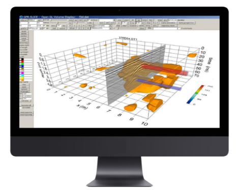
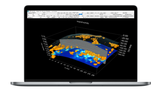
GPR Slice is the most reputable software for GPR imaging, with long-established and powerful algorithms. Since 1994, GPR Slice has been delivering the most comprehensive scope of imaging functionalities to create 2D/3D subsurface images for use in a variety of geotechnical, engineering and archaeological applications.
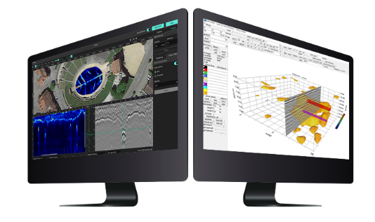
The data export capabilities allow you to use the collected data in different software environments such as AutoCAD, directly in the design process. It also allows complete integration with GPS navigation, including GPR/GPS volume imaging and time slices (also random GPR track, the yaw, tilt and pitch of the antenna) for the best positioning and orientation of the collected data. This delivers seamless integration and interpolation across all GPR/GPS tracks.
GPR-Slice is a powerful software solution, compatible with all single and multi-channel GPR systems. It also allows complete integration with GPS/TS navigation (even accounting for yaw, pitch and roll of the antenna). Subscribe to GPR-Slice to get all the advanced functionalities for your GPR data on a variety of applications.